Geolocate

Vent topographic map

Click on the map to display elevation.

About this map

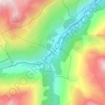
Name: Vent topographic map, elevation, terrain.

Location: Vent, Sölden, Bezirk Imst, 6458, Austria (46.84001 10.89467 46.88001 10.93467)

Average elevation: 7,779 ft

Minimum elevation: 5,958 ft

Maximum elevation: 10,164 ft

Gear up for your next adventure:

🦺Reflective Outdoor Gear - Safety gear for low‑light conditions
🌡️Portable Weather Meter - Track weather conditions on the trail
📚USA Hiking Guide Books - Top trail guides and map books
🪄Magnetic Compass - Accurate compass for navigation
🍳Camping Cook Set - Complete cookware for outdoor meals

As an Amazon Associate, this site earns from qualifying purchases at no extra cost to you.