Geolocate

Masara topographic map

Click on the map to display elevation.

About this map
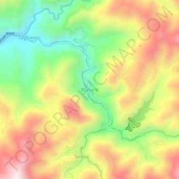
Name: Masara topographic map, elevation, terrain.

Location: Masara, Maco, Davao de Oro, Davao Region, 8806, Philippines (7.36927 126.01023 7.40927 126.05023)

Average elevation: 2,326 ft

Minimum elevation: 1,102 ft

Maximum elevation: 3,602 ft

Gear up for your next adventure:

🪶Multi‑Purpose Knife - Useful blade for camp and trail
⛺Backpacking Tents - Weight-optimized shelters for multi-day topographic surveys
🔭Telescopic Hiking Pole - Adjustable pole for hiking stability
🧦Hiking Socks - Comfortable socks to prevent blisters on long hikes
🧺Microfiber Travel Towels - Compact and fast-drying towels for trail use

As an Amazon Associate, this site earns from qualifying purchases at no extra cost to you.