Geolocate

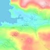
Clonmany topographic map

Click on the map to display elevation.

Clonmany

The village claims to be the youngest in Inishowen. The 18th century travel writer - Richard Pococke - did not mention the village when he toured the area in 1752. The village is mentioned in Topographia Hibernica, published in 1795. It did not feature in the census of 1841 or 1851. In the 1861 census, 112 inhabitants are recorded as living in Clonmany in 21 houses. A further 3 houses are recorded as uninhabited.

Wikipedia (CC-BY-SA 3.0)

About this map

Name: Clonmany topographic map, elevation, terrain.

Location: Clonmany, Inishowen Municipal District, County Donegal, F93 RRX6, Ireland (55.25604 -7.42756 55.26746 -7.39720)

Average elevation: 154 ft

Minimum elevation: 0 ft

Maximum elevation: 551 ft

Other topographic maps

Click on a map to view its topography, its elevation and its terrain.
Donegal

Ireland > County Donegal > Donegal

Average elevation: 157 ft

Newtown Cunningham

Ireland > County Donegal

Average elevation: 82 ft

Greencastle

Ireland > County Donegal

Average elevation: 151 ft

Portsalon

Ireland > County Donegal > Letterkenny

Average elevation: 89 ft

Mamore Gap

Ireland > County Donegal

Average elevation: 630 ft

Fintown

Ireland > County Donegal

Average elevation: 614 ft

Cashel

Ireland > County Donegal

Average elevation: 354 ft

Carndonagh

Ireland > County Donegal > Carndonagh

Average elevation: 256 ft

Maum

Ireland > County Donegal

Average elevation: 587 ft

Gear up for your next adventure:

🔌USB Car Charger - Car charger for on‑the‑go power needs
🔋Rechargeable Batteries - Power up your outdoor devices
📱Heavy-Duty Phone Cases - Drop-proof and waterproof protection for outdoor navigation
🧣Hiking Neck Gaiter - Multi‑use neck protection for outdoor weather
🚗GPS Dash Cams - Record your scenic drives through mountain passes and canyons

As an Amazon Associate, this site earns from qualifying purchases at no extra cost to you.