
Make a donation
Gear up for your next adventure:
As an Amazon Associate, this site earns from qualifying purchases at no extra cost to you.
Kermanshah topographic map
Click on the map to display elevation.
Make a donation
Gear up for your next adventure:
As an Amazon Associate, this site earns from qualifying purchases at no extra cost to you.
Kermanshah
Kermanshah has a climate which is heavily influenced by the proximity of the Zagros mountains, classified as a hot-summer Mediterranean climate (Csa) bordering on a humid continental climate (Dsa). The city's altitude and exposed location relative to westerly winds makes precipitation a little bit high (more than twice that of Tehran), but at the same time produces huge diurnal temperature swings especially in the virtually rainless summers, which remain extremely hot during the day. Kermanshah experiences rather cold winters and there are usually rainfalls in fall and spring. Snow cover is seen for at least a couple of weeks in winter.
Make a donation
Gear up for your next adventure:
As an Amazon Associate, this site earns from qualifying purchases at no extra cost to you.
About this map
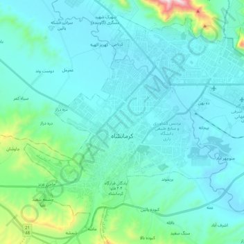
Name: Kermanshah topographic map, elevation, terrain.
Average elevation: 4,646 ft
Minimum elevation: 4,219 ft
Maximum elevation: 7,605 ft
Make a donation
Gear up for your next adventure:
As an Amazon Associate, this site earns from qualifying purchases at no extra cost to you.