
Make a donation
Gear up for your next adventure:
As an Amazon Associate, this site earns from qualifying purchases at no extra cost to you.
Behror topographic map
Click on the map to display elevation.
Make a donation
Gear up for your next adventure:
As an Amazon Associate, this site earns from qualifying purchases at no extra cost to you.
Behror
Located at co-ordinates 27°53′N 76°17′E / 27.88°N 76.28°E / 27.88; 76.28. with an average elevation of 312 metres (1,024 ft) Behror sits amidst generally plain and very fertile agricultural land with Aravali Range mountains running north–south approximately 5 km to west of Behror.
Make a donation
Gear up for your next adventure:
As an Amazon Associate, this site earns from qualifying purchases at no extra cost to you.
About this map
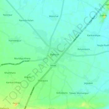
Name: Behror topographic map, elevation, terrain.
Average elevation: 1,043 ft
Minimum elevation: 1,020 ft
Maximum elevation: 1,112 ft
Make a donation
Gear up for your next adventure:
As an Amazon Associate, this site earns from qualifying purchases at no extra cost to you.