
Thank you for supporting this site ❤️
Make a donation
Make a donation
Gear up for your next adventure:
As an Amazon Associate, this site earns from qualifying purchases at no extra cost to you.
Parets topographic map
Click on the map to display elevation.
Thank you for supporting this site ❤️
Make a donation
Make a donation
Gear up for your next adventure:
As an Amazon Associate, this site earns from qualifying purchases at no extra cost to you.
About this map
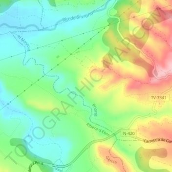
Name: Parets topographic map, elevation, terrain.
Location: Parets, el Masroig, Priorat, Tarragona, Catalonia, 43736, Spain (41.11527 0.69634 41.13527 0.71634)
Average elevation: 335 ft
Minimum elevation: 128 ft
Maximum elevation: 653 ft
Thank you for supporting this site ❤️
Make a donation
Make a donation
Gear up for your next adventure:
As an Amazon Associate, this site earns from qualifying purchases at no extra cost to you.