
Thank you for supporting this site ❤️
Make a donation
Make a donation
Gear up for your next adventure:
As an Amazon Associate, this site earns from qualifying purchases at no extra cost to you.
Cư M'gar District topographic map
Click on the map to display elevation.
Thank you for supporting this site ❤️
Make a donation
Make a donation
Gear up for your next adventure:
As an Amazon Associate, this site earns from qualifying purchases at no extra cost to you.
About this map
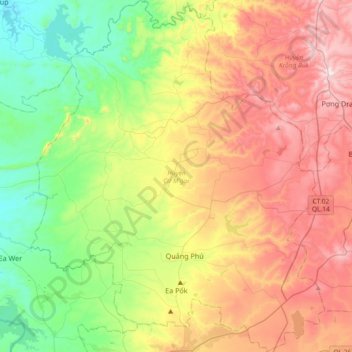
Name: Cư M'gar District topographic map, elevation, terrain.
Location: Cư M'gar District, Đắk Lắk Province, Vietnam (12.71557 107.91686 13.07603 108.22667)
Average elevation: 1,542 ft
Minimum elevation: 627 ft
Maximum elevation: 2,808 ft
Thank you for supporting this site ❤️
Make a donation
Make a donation
Gear up for your next adventure:
As an Amazon Associate, this site earns from qualifying purchases at no extra cost to you.