Geolocate

Kelnor topographic map

Click on the map to display elevation.

About this map

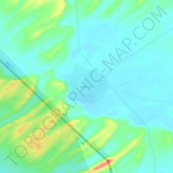
Name: Kelnor topographic map, elevation, terrain.

Location: Kelnor, Chohtan Tehsil, Barmer, Rajasthan, India (25.32972 70.71121 25.36972 70.75121)

Average elevation: 538 ft

Minimum elevation: 476 ft

Maximum elevation: 719 ft

Gear up for your next adventure:

📖Nature Tracking Books - Learn to track wildlife and terrain
🕶️GPS Smartphone Mount - Secure mount for phone navigation
🔥Camping Stove - Portable stove for camping and backcountry cooking
🧭Hiking Compass - Precision compass for reliable navigation in the wilderness
Backpacking Tents - Weight-optimized shelters for multi-day topographic surveys

As an Amazon Associate, this site earns from qualifying purchases at no extra cost to you.