Geolocate

Sedgefield topographic map

Click on the map to display elevation.

About this map

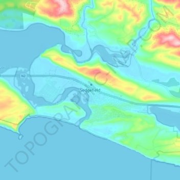
Name: Sedgefield topographic map, elevation, terrain.

Location: Sedgefield, George, Western Cape, 6573, South Africa (-34.05561 22.76277 -33.97561 22.84277)

Average elevation: 135 ft

Minimum elevation: -13 ft

Maximum elevation: 807 ft

Other topographic maps

Click on a map to view its topography, its elevation and its terrain.

Oudtshoorn

South Africa > Western Cape > George

Average elevation: 1,158 ft

Touwsranten

South Africa > Western Cape > George

Average elevation: 663 ft

Danabaai

South Africa > Western Cape > George

Average elevation: 358 ft

Oudtshoorn

South Africa > Western Cape > George

Average elevation: 1,158 ft

Friemersheim

South Africa > Western Cape > George

Average elevation: 860 ft

Oudtshoorn

South Africa > Western Cape > George

Average elevation: 1,158 ft

Garden Route Dam

South Africa > Western Cape > George

Average elevation: 656 ft

Gear up for your next adventure:

🛶Inflatable Kayak - Portable kayak for rivers, lakes, and expeditions
🌄Hiking Binoculars - Compact binoculars for scenic views and trail spotting
📚USA Hiking Guide Books - Top trail guides and map books
🥾Men's Hiking Boots - Durable, waterproof footwear for rugged terrain and steep inclines
📱Heavy-Duty Phone Cases - Drop-proof and waterproof protection for outdoor navigation

As an Amazon Associate, this site earns from qualifying purchases at no extra cost to you.