Geolocate

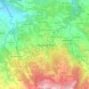
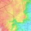
Bendungan topographic map

Click on the map to display elevation.

About this map

Name: Bendungan topographic map, elevation, terrain.

Location: Bendungan, Gajah Mungkur, Semarang, Central Java, Java, Indonesia (-7.00546 110.40521 -6.99577 110.41384)

Average elevation: 141 ft

Minimum elevation: 10 ft

Maximum elevation: 394 ft

Other topographic maps

Click on a map to view its topography, its elevation and its terrain.
Ngaliyan

Indonesia > Central Java > Semarang

Average elevation: 410 ft

Gunungpati

Indonesia > Central Java > Semarang

Average elevation: 994 ft

Tembalang

Indonesia > Central Java > Semarang > Bulusan

Average elevation: 636 ft

Candisari

Indonesia > Central Java > Semarang

Average elevation: 413 ft

Tambakaji

Indonesia > Central Java > Semarang

Average elevation: 197 ft

Gajahmungkur

Indonesia > Central Java > Semarang

Average elevation: 210 ft

Tikung

Indonesia > Central Java > Semarang

Average elevation: 72 ft

Ampelgading

Indonesia > Central Java > Semarang

Average elevation: 643 ft

Kramas

Indonesia > Central Java > Semarang

Average elevation: 558 ft

Gear up for your next adventure:

📷Action Cameras - Rugged cameras to document your journeys across rugged terrain
🪶Thermal Camp Blanket - Extra warmth for cold nights
🌐World Map Poster - Decorative world maps with topographic info
🥇GPS Hiking Watch - Multi‑sport GPS watch with navigation and trail tracking
🪶Wildlife Field Guides - Learn animal tracking and species ID

As an Amazon Associate, this site earns from qualifying purchases at no extra cost to you.