
Make a donation
Gear up for your next adventure:
As an Amazon Associate, this site earns from qualifying purchases at no extra cost to you.
San Sebastián topographic map
Click on the map to display elevation.
Make a donation
Gear up for your next adventure:
As an Amazon Associate, this site earns from qualifying purchases at no extra cost to you.
San Sebastián
San Sebastián cuenta con un área de 3,97 km² y una altitud media de 1125 m s. n. m.
Make a donation
Gear up for your next adventure:
As an Amazon Associate, this site earns from qualifying purchases at no extra cost to you.
About this map
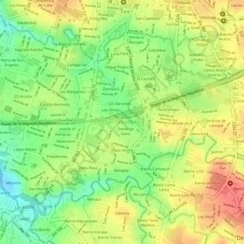
Name: San Sebastián topographic map, elevation, terrain.
Location: San Sebastián, Cantón de San José, San José, 10111, Costa Rica (9.89988 -84.09621 9.92083 -84.06833)
Average elevation: 3,730 ft
Minimum elevation: 3,612 ft
Maximum elevation: 3,825 ft
Make a donation
Gear up for your next adventure:
As an Amazon Associate, this site earns from qualifying purchases at no extra cost to you.
Other topographic maps
Click on a map to view its topography, its elevation and its terrain.