
Thank you for supporting this site ❤️
Make a donation
Make a donation
Gear up for your next adventure:
As an Amazon Associate, this site earns from qualifying purchases at no extra cost to you.
Odela topographic map
Click on the map to display elevation.
Thank you for supporting this site ❤️
Make a donation
Make a donation
Gear up for your next adventure:
As an Amazon Associate, this site earns from qualifying purchases at no extra cost to you.
About this map
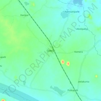
Name: Odela topographic map, elevation, terrain.
Location: Odela, Odela mandal, Peddapalli, Telangana, 505152, India (18.41432 79.40728 18.49432 79.48728)
Average elevation: 705 ft
Minimum elevation: 633 ft
Maximum elevation: 1,004 ft
Thank you for supporting this site ❤️
Make a donation
Make a donation
Gear up for your next adventure:
As an Amazon Associate, this site earns from qualifying purchases at no extra cost to you.