
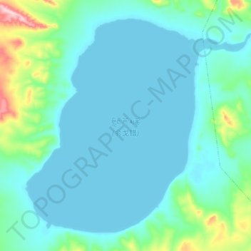
令戈错 topographic map
Interactive map
Click on the map to display elevation.
About this map
Name: 令戈错 topographic map, elevation, terrain.
Location: 令戈错, 嘎措乡, 双湖县, 那曲市, 西藏自治区, 中国 (33.78975 88.52525 33.91200 88.69775)
Average elevation: 16,719 ft
Minimum elevation: 16,598 ft
Maximum elevation: 17,470 ft
令戈错(藏語:གླིང་ཀོ་མཚོ,威利转写:gling ko mtsho,THL:Lingko Tso)位于中国西藏自治区北部那曲市尼玛县境内,地处尼玛县东部,强仁温杂日西南麓,湖面海拔5051米,面积89平方公里。湖水以冰雪融水径流和泉水补给为主。湖区属于高寒草原半干旱气候,年均气温-6℃,年降水量150~200毫米。
Other topographic maps
Click on a map to view its topography, its elevation and its terrain.