
Thank you for supporting this site ❤️
Make a donation
Make a donation
Gear up for your next adventure:
As an Amazon Associate, this site earns from qualifying purchases at no extra cost to you.
Playas topographic map
Click on the map to display elevation.
Thank you for supporting this site ❤️
Make a donation
Make a donation
Gear up for your next adventure:
As an Amazon Associate, this site earns from qualifying purchases at no extra cost to you.
About this map
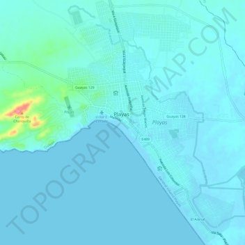
Name: Playas topographic map, elevation, terrain.
Location: Playas, General Villamil Playas, Playas, Guayas, Ecuador (-2.66773 -80.40532 -2.60770 -80.36366)
Average elevation: 30 ft
Minimum elevation: 0 ft
Maximum elevation: 315 ft
Thank you for supporting this site ❤️
Make a donation
Make a donation
Gear up for your next adventure:
As an Amazon Associate, this site earns from qualifying purchases at no extra cost to you.