Geolocate

Kasyoro topographic map

Click on the map to display elevation.

About this map

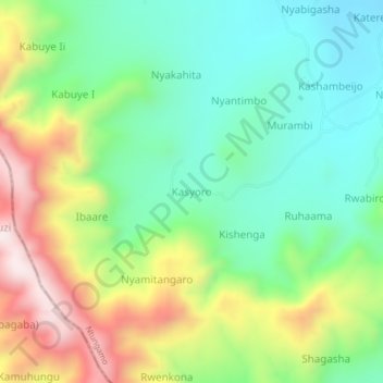
Name: Kasyoro topographic map, elevation, terrain.

Location: Kasyoro, Ntungamo, Western Region, Uganda (-1.09493 30.06998 -1.05493 30.10998)

Average elevation: 5,876 ft

Minimum elevation: 5,154 ft

Maximum elevation: 7,142 ft

Gear up for your next adventure:

📡GPS Antenna Upgrade - Enhance GPS reception in remote terrain
🧭Hiking Compass - Precision compass for reliable navigation in the wilderness
🧥Waterproof Jacket for Hiking - Breathable and rugged rain jacket for outdoor excursions
❄️Traction Cleats - Prevent slips on icy trails during winter hikes
🥇GPS Hiking Watch - Multi‑sport GPS watch with navigation and trail tracking

As an Amazon Associate, this site earns from qualifying purchases at no extra cost to you.