
Thank you for supporting this site ❤️
Make a donation
Make a donation
Gear up for your next adventure:
As an Amazon Associate, this site earns from qualifying purchases at no extra cost to you.
Sendana topographic map
Click on the map to display elevation.
Thank you for supporting this site ❤️
Make a donation
Make a donation
Gear up for your next adventure:
As an Amazon Associate, this site earns from qualifying purchases at no extra cost to you.
About this map
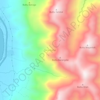
Name: Sendana topographic map, elevation, terrain.
Location: Sendana, Majene, West Sulawesi, Sulawesi, Indonesia (-3.32466 118.85711 -3.28466 118.89711)
Average elevation: 1,529 ft
Minimum elevation: 0 ft
Maximum elevation: 3,136 ft
Thank you for supporting this site ❤️
Make a donation
Make a donation
Gear up for your next adventure:
As an Amazon Associate, this site earns from qualifying purchases at no extra cost to you.