
Thank you for supporting this site ❤️
Make a donation
Make a donation
Gear up for your next adventure:
As an Amazon Associate, this site earns from qualifying purchases at no extra cost to you.
Kumgeçit topographic map
Click on the map to display elevation.
Thank you for supporting this site ❤️
Make a donation
Make a donation
Gear up for your next adventure:
As an Amazon Associate, this site earns from qualifying purchases at no extra cost to you.
About this map
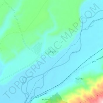
Name: Kumgeçit topographic map, elevation, terrain.
Location: Kumgeçit, Bingöl, Eastern Anatolia Region, Turkey (38.77661 40.59820 38.81661 40.63820)
Average elevation: 3,389 ft
Minimum elevation: 3,248 ft
Maximum elevation: 4,052 ft
Thank you for supporting this site ❤️
Make a donation
Make a donation
Gear up for your next adventure:
As an Amazon Associate, this site earns from qualifying purchases at no extra cost to you.