Geolocate

Carver topographic map

Click on the map to display elevation.

About this map

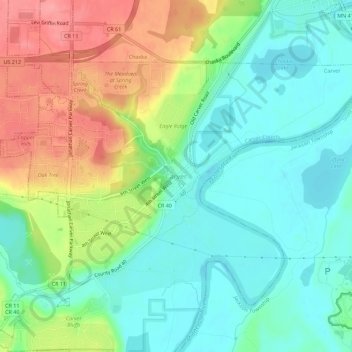
Name: Carver topographic map, elevation, terrain.

Location: Carver, Carver County, Minnesota, 55379-8944, United States (44.74357 -93.64579 44.78357 -93.60579)

Average elevation: 794 ft

Minimum elevation: 682 ft

Maximum elevation: 994 ft

Gear up for your next adventure:

🛏️Cold Weather Sleeping Bag - Warm sleeping bag for cold conditions
🎒Hydration Pack - Hands‑free water reservoir for long hikes
🔭Telescopic Hiking Pole - Adjustable pole for hiking stability
🌄Hiking Binoculars - Compact binoculars for scenic views and trail spotting
📶Vehicle Signal Boosters - Improve reception in rural areas while driving to trailheads

As an Amazon Associate, this site earns from qualifying purchases at no extra cost to you.