
Thank you for supporting this site ❤️
Make a donation
Make a donation
Gear up for your next adventure:
As an Amazon Associate, this site earns from qualifying purchases at no extra cost to you.
Pietramula topographic map
Click on the map to display elevation.
Thank you for supporting this site ❤️
Make a donation
Make a donation
Gear up for your next adventure:
As an Amazon Associate, this site earns from qualifying purchases at no extra cost to you.
About this map
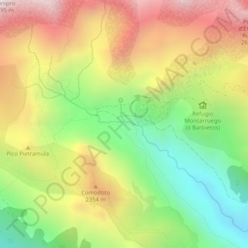
Name: Pietramula topographic map, elevation, terrain.
Location: Pietramula, Bielsa, Sobrarbe, Huesca, Aragon, Espagne (42.67154 0.12363 42.69154 0.14363)
Average elevation: 6,919 ft
Minimum elevation: 5,177 ft
Maximum elevation: 8,871 ft
Thank you for supporting this site ❤️
Make a donation
Make a donation
Gear up for your next adventure:
As an Amazon Associate, this site earns from qualifying purchases at no extra cost to you.