
городской округ Армавир topographic map
Interactive map
Click on the map to display elevation.
About this map
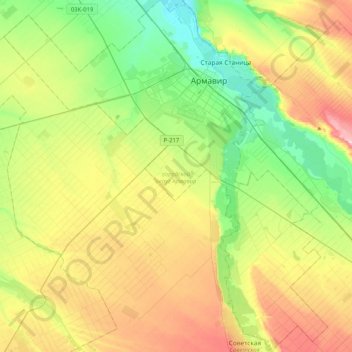
Name: городской округ Армавир topographic map, elevation, terrain.
Average elevation: 814 ft
Minimum elevation: 502 ft
Maximum elevation: 1,319 ft
Other topographic maps
Click on a map to view its topography, its elevation and its terrain.
Armavir
Russia > Krasnodar Krai > городской округ Армавир > Armavir
Armavir, городской округ Армавир, Krasnodar Krai, Southern Federal District, 352901, Russia
Average elevation: 771 ft