
Porrera topographic map
Click on the map to display elevation.
About this map
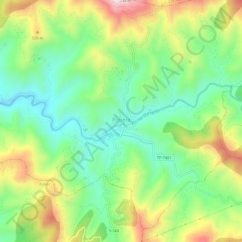
Name: Porrera topographic map, elevation, terrain.
Location: Porrera, Priorat, Tarragona, Catalonia, 43739, Spain (41.16874 0.83613 41.20874 0.87613)
Average elevation: 1,411 ft
Minimum elevation: 837 ft
Maximum elevation: 2,336 ft