
Tombstone topographic map
Click on the map to display elevation.
Tombstone
The Tombstone District located at 31°42′57″N 110°3′53″W / 31.71583°N 110.06472°W / 31.71583; -110.06472 (31.715940, −110.064827) sits atop a mesa (elevation 4,539 feet ) in the San Pedro River valley between the Huachuca Mountains and Whetstone Mountains to the west, and the Mules and the Dragoon Mountains to the east. According to the United States Census Bureau, the city has a total area of 4.3 square miles (11.2 km2), all land.
About this map
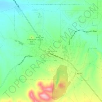
Name: Tombstone topographic map, elevation, terrain.
Location: Tombstone, Cochise County, Arizona, 85638, United States (31.69423 -110.08520 31.73423 -110.04520)
Average elevation: 4,505 ft
Minimum elevation: 4,275 ft
Maximum elevation: 4,977 ft
Cochise County trails, hiking, mountain biking, running and outdoor activities