Geolocate

Calera topographic map

Click on the map to display elevation.

About this map

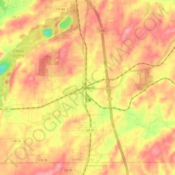
Name: Calera topographic map, elevation, terrain.

Location: Calera, Shelby County, Alabama, 35040, United States (33.06350 -86.79057 33.14350 -86.71057)

Average elevation: 551 ft

Minimum elevation: 305 ft

Maximum elevation: 686 ft

Shelby County trails, hiking, mountain biking, running and outdoor activities

Gear up for your next adventure:

🧢Sun Protection Hats - Wide-brimmed and UPF-rated hats for high-altitude sun safety
🧷Carabiner Set - Durable clips for gear attachment
🔊Portable Camp Speaker - Music and alerts at camp
🎒Outdoor Daypacks - Lightweight backpacks designed for carrying maps and essential gear
🌎3D Topographic Globes - Raised relief globes for a tactile understanding of geography

As an Amazon Associate, this site earns from qualifying purchases at no extra cost to you.