
Lac Hippolyte topographic map
Interactive map
Click on the map to display elevation.
About this map
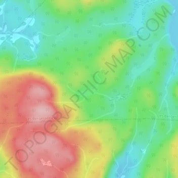
Name: Lac Hippolyte topographic map, elevation, terrain.
Average elevation: 630 ft
Minimum elevation: 400 ft
Maximum elevation: 955 ft
Other topographic maps
Click on a map to view its topography, its elevation and its terrain.
Lac du Rat Musqué
Canada > Québec > Sacré-Coeur
Lac du Rat Musqué, Route 172, Sacré-Coeur, La Haute-Côte-Nord, Saguenay - Lac-Saint-Jean, Québec, Canada
Average elevation: 1,178 ft