
Thank you for supporting this site ❤️
Make a donation
Make a donation
Gear up for your next adventure:
As an Amazon Associate, this site earns from qualifying purchases at no extra cost to you.
Einsiedel topographic map
Click on the map to display elevation.
Thank you for supporting this site ❤️
Make a donation
Make a donation
Gear up for your next adventure:
As an Amazon Associate, this site earns from qualifying purchases at no extra cost to you.
About this map
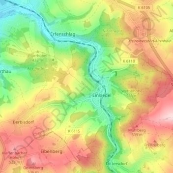
Name: Einsiedel topographic map, elevation, terrain.
Location: Einsiedel, Chemnitz, Saxony, Germany (50.75029 12.92703 50.79300 13.00491)
Average elevation: 1,411 ft
Minimum elevation: 1,040 ft
Maximum elevation: 1,804 ft
Thank you for supporting this site ❤️
Make a donation
Make a donation
Gear up for your next adventure:
As an Amazon Associate, this site earns from qualifying purchases at no extra cost to you.