
Thank you for supporting this site ❤️
Make a donation
Make a donation
Gear up for your next adventure:
As an Amazon Associate, this site earns from qualifying purchases at no extra cost to you.
Cedillo topographic map
Click on the map to display elevation.
Thank you for supporting this site ❤️
Make a donation
Make a donation
Gear up for your next adventure:
As an Amazon Associate, this site earns from qualifying purchases at no extra cost to you.
About this map
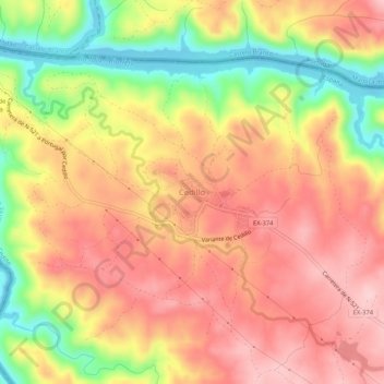
Name: Cedillo topographic map, elevation, terrain.
Location: Cedillo, Valencia de Alcántara, Cáceres, Extremadura, España (39.63177 -7.52016 39.67177 -7.48016)
Average elevation: 755 ft
Minimum elevation: 364 ft
Maximum elevation: 1,017 ft
Thank you for supporting this site ❤️
Make a donation
Make a donation
Gear up for your next adventure:
As an Amazon Associate, this site earns from qualifying purchases at no extra cost to you.