
Zelenograd topographic map
Interactive map
Click on the map to display elevation.
About this map
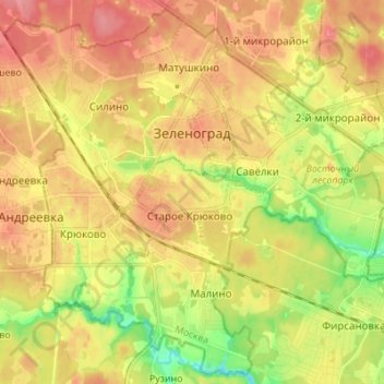
Name: Zelenograd topographic map, elevation, terrain.
Location: Zelenograd, Moscow, Central Federal District, Russia (55.94801 37.13160 56.02122 37.26830)
Average elevation: 679 ft
Minimum elevation: 541 ft
Maximum elevation: 784 ft