
Thank you for supporting this site ❤️
Make a donation
Make a donation
Gear up for your next adventure:
As an Amazon Associate, this site earns from qualifying purchases at no extra cost to you.
Fraternidad topographic map
Click on the map to display elevation.
Thank you for supporting this site ❤️
Make a donation
Make a donation
Gear up for your next adventure:
As an Amazon Associate, this site earns from qualifying purchases at no extra cost to you.
About this map
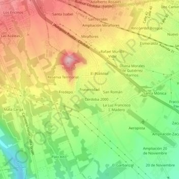
Name: Fraternidad topographic map, elevation, terrain.
Location: Fraternidad, El Pueblito, Córdoba, Veracruz, 94540, Mexico (18.86165 -96.99174 18.90165 -96.95174)
Average elevation: 2,989 ft
Minimum elevation: 2,612 ft
Maximum elevation: 3,369 ft
Thank you for supporting this site ❤️
Make a donation
Make a donation
Gear up for your next adventure:
As an Amazon Associate, this site earns from qualifying purchases at no extra cost to you.