Geolocate

Eureka topographic map

Click on the map to display elevation.

About this map

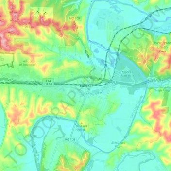
Name: Eureka topographic map, elevation, terrain.

Location: Eureka, Saint Louis County, Missouri, 63025, United States (38.46255 -90.66790 38.54255 -90.58790)

Average elevation: 538 ft

Minimum elevation: 390 ft

Maximum elevation: 886 ft

Saint Louis County trails, hiking, mountain biking, running and outdoor activities

Gear up for your next adventure:

🔊Portable Camp Speaker - Music and alerts at camp
🔪Outdoor Multitools - Essential survival tools for gear repair and field use
🧼Biodegradable Camping Soap - Eco‑friendly soap for outdoor hygiene
🥘Titanium Cookware - Durable, featherlight pots and pans for backpacking
🧦Hiking Socks - Comfortable socks to prevent blisters on long hikes

As an Amazon Associate, this site earns from qualifying purchases at no extra cost to you.