Geolocate

Lauscha topographic map

Click on the map to display elevation.

About this map

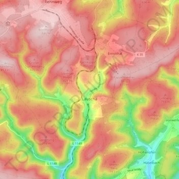
Name: Lauscha topographic map, elevation, terrain.

Location: Lauscha, Landkreis Sonneberg, Thuringia, Germany (50.45019 11.10672 50.50641 11.20688)

Average elevation: 2,402 ft

Minimum elevation: 1,732 ft

Maximum elevation: 2,785 ft

Gear up for your next adventure:

📷Action Cameras - Rugged cameras to document your journeys across rugged terrain
🪶Compact Camp Shovel - Folding shovel for campsite tasks
🪶Camp Gear Gift Set - Perfect gift bundle for outdoor fans
💧Water Purification System - Clean water on the trail with reliable purifiers
🦟Ultrasonic Repellers - Create a bug-free zone at your camp or rest stop

As an Amazon Associate, this site earns from qualifying purchases at no extra cost to you.