Geolocate

Hun topographic map

Click on the map to display elevation.

About this map

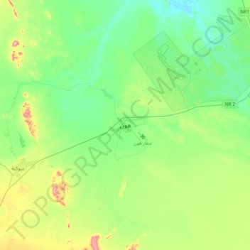
Name: Hun topographic map, elevation, terrain.

Location: Hun, District of Al-Jufra, Libya (28.96456 15.78026 29.28456 16.10026)

Average elevation: 906 ft

Minimum elevation: 725 ft

Maximum elevation: 1,404 ft

Gear up for your next adventure:

🧷Carabiner Set - Durable clips for gear attachment
🧢Sun Protection Hats - Wide-brimmed and UPF-rated hats for high-altitude sun safety
🔊Portable Camp Speaker - Music and alerts at camp
📱Heavy-Duty Phone Cases - Drop-proof and waterproof protection for outdoor navigation
🪑Ultralight Camp Chairs - Portable seating for resting after a long day of mapping

As an Amazon Associate, this site earns from qualifying purchases at no extra cost to you.