
Thank you for supporting this site ❤️
Make a donation
Make a donation
Gear up for your next adventure:
As an Amazon Associate, this site earns from qualifying purchases at no extra cost to you.
Frattina topographic map
Click on the map to display elevation.
Thank you for supporting this site ❤️
Make a donation
Make a donation
Gear up for your next adventure:
As an Amazon Associate, this site earns from qualifying purchases at no extra cost to you.
About this map
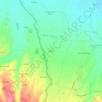
Name: Frattina topographic map, elevation, terrain.
Location: Frattina, Agazzano, Piacenza, Emilia-Romagna, Italy (44.95490 9.51693 44.99490 9.55693)
Average elevation: 384 ft
Minimum elevation: 282 ft
Maximum elevation: 577 ft
Thank you for supporting this site ❤️
Make a donation
Make a donation
Gear up for your next adventure:
As an Amazon Associate, this site earns from qualifying purchases at no extra cost to you.