Geolocate

Adell topographic map

Click on the map to display elevation.

About this map

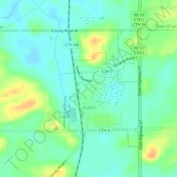
Name: Adell topographic map, elevation, terrain.

Location: Adell, Sheboygan County, Wisconsin, United States (43.61318 -87.95620 43.63099 -87.94135)

Average elevation: 912 ft

Minimum elevation: 873 ft

Maximum elevation: 991 ft

Sheboygan County trails, hiking, mountain biking, running and outdoor activities

Gear up for your next adventure:

🛌Ultralight Sleeping Bags - Compact down bags for cold nights in the wilderness
🔋Rechargeable Batteries - Power up your outdoor devices
🔌USB Car Charger - Car charger for on‑the‑go power needs
🍳Camping Cook Set - Complete cookware for outdoor meals
🪶Camp Gear Gift Set - Perfect gift bundle for outdoor fans

As an Amazon Associate, this site earns from qualifying purchases at no extra cost to you.