Geolocate

Graham topographic map

Click on the map to display elevation.

About this map

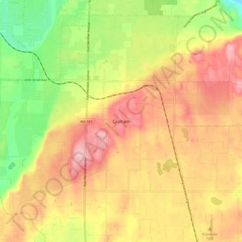
Name: Graham topographic map, elevation, terrain.

Location: Graham, Pierce County, Washington, 09339, United States (46.99960 -122.31857 47.07960 -122.23857)

Average elevation: 666 ft

Minimum elevation: 305 ft

Maximum elevation: 968 ft

Pierce County trails, hiking, mountain biking, running and outdoor activities

Gear up for your next adventure:

🥾Hiking Shoes - Durable and comfortable shoes for trail hiking
📶Satellite Messenger - Communication device off‑grid
🧤Tactile Hiking Gloves - Keep hands warm while operating GPS and smartphone screens
🧼Biodegradable Camping Soap - Eco‑friendly soap for outdoor hygiene
🕶️GPS Smartphone Mount - Secure mount for phone navigation

As an Amazon Associate, this site earns from qualifying purchases at no extra cost to you.