
Thank you for supporting this site ❤️
Make a donation
Make a donation
Gear up for your next adventure:
As an Amazon Associate, this site earns from qualifying purchases at no extra cost to you.
Cushing topographic map
Click on the map to display elevation.
Thank you for supporting this site ❤️
Make a donation
Make a donation
Gear up for your next adventure:
As an Amazon Associate, this site earns from qualifying purchases at no extra cost to you.
About this map
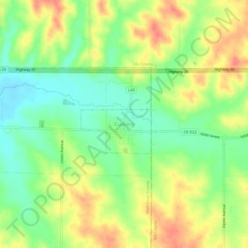
Name: Cushing topographic map, elevation, terrain.
Location: Cushing, Woodbury County, Iowa, 51018, United States (42.44576 -95.69510 42.48576 -95.65510)
Average elevation: 1,329 ft
Minimum elevation: 1,234 ft
Maximum elevation: 1,437 ft
Woodbury County trails, hiking, mountain biking, running and outdoor activities
Thank you for supporting this site ❤️
Make a donation
Make a donation
Gear up for your next adventure:
As an Amazon Associate, this site earns from qualifying purchases at no extra cost to you.