Geolocate

Rodeobamba topographic map

Click on the map to display elevation.

About this map

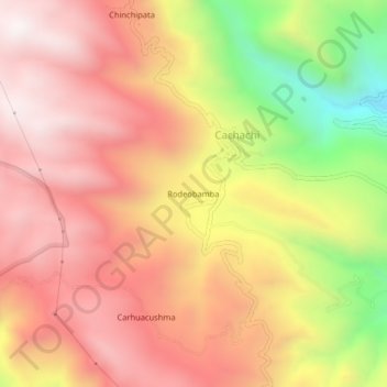
Name: Rodeobamba topographic map, elevation, terrain.

Location: Rodeobamba, Cachachi, Cajabamba, Cajamarca, Perú (-7.47488 -78.29328 -7.43488 -78.25328)

Average elevation: 10,997 ft

Minimum elevation: 8,875 ft

Maximum elevation: 12,320 ft

Gear up for your next adventure:

🛏️Cold Weather Sleeping Bag - Warm sleeping bag for cold conditions
🌐World Map Poster - Decorative world maps with topographic info
🥤Water Filter Bottle - All‑in‑one filter bottle for safe hydration
🛰️Satellite Messengers - Emergency SOS and two-way messaging for off-grid adventures
🪶Camp Gear Gift Set - Perfect gift bundle for outdoor fans

As an Amazon Associate, this site earns from qualifying purchases at no extra cost to you.