
Thank you for supporting this site ❤️
Make a donation
Make a donation
Gear up for your next adventure:
As an Amazon Associate, this site earns from qualifying purchases at no extra cost to you.
Moses H Cone Memorial Park topographic map
Click on the map to display elevation.
Thank you for supporting this site ❤️
Make a donation
Make a donation
Gear up for your next adventure:
As an Amazon Associate, this site earns from qualifying purchases at no extra cost to you.
About this map
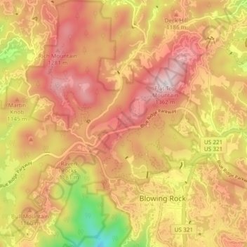
Name: Moses H Cone Memorial Park topographic map, elevation, terrain.
Average elevation: 3,678 ft
Minimum elevation: 2,415 ft
Maximum elevation: 4,518 ft
Watauga County trails, hiking, mountain biking, running and outdoor activities
Thank you for supporting this site ❤️
Make a donation
Make a donation
Gear up for your next adventure:
As an Amazon Associate, this site earns from qualifying purchases at no extra cost to you.
Other topographic maps
Click on a map to view its topography, its elevation and its terrain.
Laurel Park
United States > North Carolina > Watauga County > Blowing Rock
Average elevation: 3,159 ft