
Bastrop topographic map
Click on the map to display elevation.
About this map
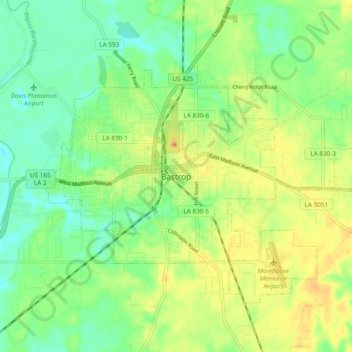
Name: Bastrop topographic map, elevation, terrain.
Location: Bastrop, Morehouse Parish, Louisiana, 71220, United States (32.73614 -91.94830 32.81614 -91.86830)
Average elevation: 125 ft
Minimum elevation: 62 ft
Maximum elevation: 210 ft
Morehouse Parish trails, hiking, mountain biking, running and outdoor activities