Geolocate

Battah topographic map

Click on the map to display elevation.

About this map

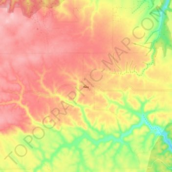
Name: Battah topographic map, elevation, terrain.

Location: Battah, Marj, Libya (32.61748 21.06772 32.69748 21.14772)

Average elevation: 1,125 ft

Minimum elevation: 794 ft

Maximum elevation: 1,335 ft

Other topographic maps

Click on a map to view its topography, its elevation and its terrain.

Al Kharobah

Libya > Marj

Average elevation: 823 ft

Gear up for your next adventure:

🧯Emergency Survival Kit - All‑in‑one survival essentials for the backcountry
☀️Outdoor Sunscreen - High protection sunscreen for outdoor activities
🩳Quick‑Dry Hiking Shorts - Comfortable and quick‑dry shorts for summer hiking
👖Convertible Hiking Pants - Versatile zip-off pants for changing altitudes and temperatures
🧦Merino Wool Socks - Moisture-wicking, blister-preventing socks for long treks

As an Amazon Associate, this site earns from qualifying purchases at no extra cost to you.