Geolocate

Hillside topographic map

Click on the map to display elevation.

About this map

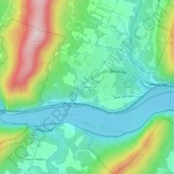
Name: Hillside topographic map, elevation, terrain.

Location: Hillside, Washington County, Maryland, United States (39.30973 -77.72175 39.34973 -77.68175)

Average elevation: 594 ft

Minimum elevation: 220 ft

Maximum elevation: 1,444 ft

Washington County trails, hiking, mountain biking, running and outdoor activities

Gear up for your next adventure:

📡Handheld GPS Device - Reliable handheld GPS for outdoor navigation
🦶Carbon Trekking Poles - Reduce knee impact on steep descents with ultra-light poles
🪶Trail Camera - Capture wildlife on your hikes
🧭Pro Hiking Compasses - High-accuracy liquid-filled compasses for topographic orientation
🧼Biodegradable Camping Soap - Eco‑friendly soap for outdoor hygiene

As an Amazon Associate, this site earns from qualifying purchases at no extra cost to you.