
Kampung Labohan topographic map
Click on the map to display elevation.
About this map
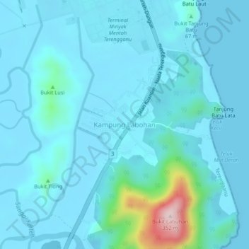
Name: Kampung Labohan topographic map, elevation, terrain.
Location: Kampung Labohan, Kemaman District, Terengganu, Malaysia (4.52228 103.43663 4.56228 103.47663)
Average elevation: 115 ft
Minimum elevation: -3 ft
Maximum elevation: 1,125 ft
Other topographic maps
Click on a map to view its topography, its elevation and its terrain.
Stadium Mini Mak Chili
Malaysia > Terengganu > Kemaman District > Kampung Kaya
Average elevation: 23 ft
Sungai Kandang Rusa
Malaysia > Terengganu > Kemaman District > Kampung Semayor
Average elevation: 105 ft