Geolocate

Torrey topographic map

Click on the map to display elevation.

About this map

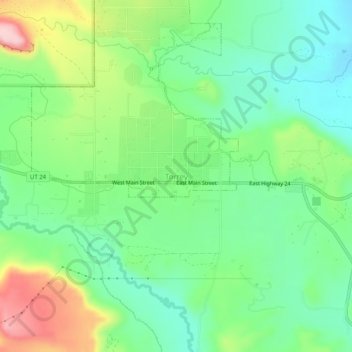
Name: Torrey topographic map, elevation, terrain.

Location: Torrey, Wayne County, Utah, 84773, United States (38.27974 -111.44047 38.31974 -111.40047)

Average elevation: 6,854 ft

Minimum elevation: 6,614 ft

Maximum elevation: 7,316 ft

Wayne County trails, hiking, mountain biking, running and outdoor activities

Gear up for your next adventure:

🔭Telescopic Hiking Pole - Adjustable pole for hiking stability
🔌USB Car Charger - Car charger for on‑the‑go power needs
🧭Compass with Lanyard - Easy‑carry compass for navigation
🍳Camping Cook Set - Complete cookware for outdoor meals
🗻Climbing Gear Basics - Essential gear for beginner climbers

As an Amazon Associate, this site earns from qualifying purchases at no extra cost to you.