
Tolland topographic map
Click on the map to display elevation.
About this map
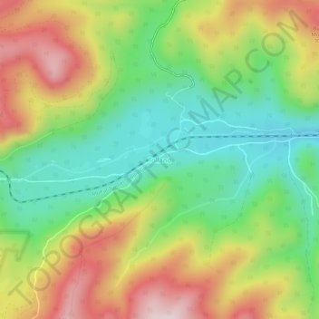
Name: Tolland topographic map, elevation, terrain.
Location: Tolland, Gilpin County, Colorado, 80474, United States (39.88475 -105.60941 39.92475 -105.56941)
Average elevation: 9,442 ft
Minimum elevation: 8,766 ft
Maximum elevation: 10,358 ft
Gilpin County trails, hiking, mountain biking, running and outdoor activities
Other topographic maps
Click on a map to view its topography, its elevation and its terrain.
East Portal Distributed Camping Area
United States > Colorado > Gilpin County
Average elevation: 9,977 ft