
Thank you for supporting this site ❤️
Make a donation
Make a donation
Gear up for your next adventure:
As an Amazon Associate, this site earns from qualifying purchases at no extra cost to you.
Milreu topographic map
Click on the map to display elevation.
Thank you for supporting this site ❤️
Make a donation
Make a donation
Gear up for your next adventure:
As an Amazon Associate, this site earns from qualifying purchases at no extra cost to you.
About this map
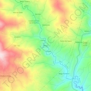
Name: Milreu topographic map, elevation, terrain.
Location: Milreu, Alvares, Góis, Coimbra, 3270-084, Portugal (39.98015 -8.15789 40.02015 -8.11789)
Average elevation: 1,575 ft
Minimum elevation: 935 ft
Maximum elevation: 2,362 ft
Thank you for supporting this site ❤️
Make a donation
Make a donation
Gear up for your next adventure:
As an Amazon Associate, this site earns from qualifying purchases at no extra cost to you.