Geolocate

Tanaff topographic map

Click on the map to display elevation.

About this map

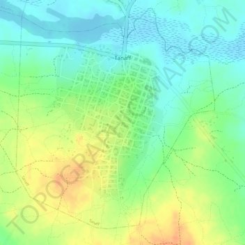
Name: Tanaff topographic map, elevation, terrain.

Location: Tanaff, Département de Goudomp, Sédhiou Region, Senegal (12.63673 -15.43993 12.66012 -15.41748)

Average elevation: 62 ft

Minimum elevation: -3 ft

Maximum elevation: 135 ft

Gear up for your next adventure:

❄️Traction Cleats - Prevent slips on icy trails during winter hikes
🪶Camp Gear Gift Set - Perfect gift bundle for outdoor fans
🧤Tactile Hiking Gloves - Keep hands warm while operating GPS and smartphone screens
👓Polarized Sunglasses - Outdoor sunglasses for glare reduction
🧼Biodegradable Camping Soap - Eco‑friendly soap for outdoor hygiene

As an Amazon Associate, this site earns from qualifying purchases at no extra cost to you.