Geolocate

Santa Rosa topographic map

Click on the map to display elevation.

About this map

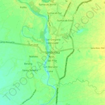
Name: Santa Rosa topographic map, elevation, terrain.

Location: Santa Rosa, Nueva Ecija, Central Luzon, Philippines (15.38471 120.89805 15.46471 120.97805)

Average elevation: 89 ft

Minimum elevation: 56 ft

Maximum elevation: 115 ft

Gear up for your next adventure:

GPS Sports Watch - GPS watch for running, hiking and training
🦟Ultrasonic Repellers - Create a bug-free zone at your camp or rest stop
🔋Solar Power Banks - Keep your GPS and phone charged in remote wilderness areas
📖Nature Tracking Books - Learn to track wildlife and terrain
🧥Waterproof Jacket for Hiking - Breathable and rugged rain jacket for outdoor excursions

As an Amazon Associate, this site earns from qualifying purchases at no extra cost to you.