
Benton topographic map
Click on the map to display elevation.
About this map
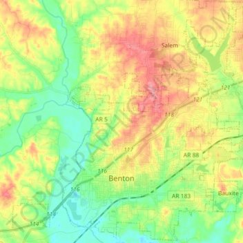
Name: Benton topographic map, elevation, terrain.
Location: Benton, Saline County, Arkansas, 72015, United States (34.53408 -92.65113 34.65024 -92.50824)
Average elevation: 397 ft
Minimum elevation: 256 ft
Maximum elevation: 591 ft
Saline County trails, hiking, mountain biking, running and outdoor activities
Other topographic maps
Click on a map to view its topography, its elevation and its terrain.