
Thank you for supporting this site ❤️
Make a donation
Make a donation
Gear up for your next adventure:
As an Amazon Associate, this site earns from qualifying purchases at no extra cost to you.
Ghasi topographic map
Click on the map to display elevation.
Thank you for supporting this site ❤️
Make a donation
Make a donation
Gear up for your next adventure:
As an Amazon Associate, this site earns from qualifying purchases at no extra cost to you.
About this map
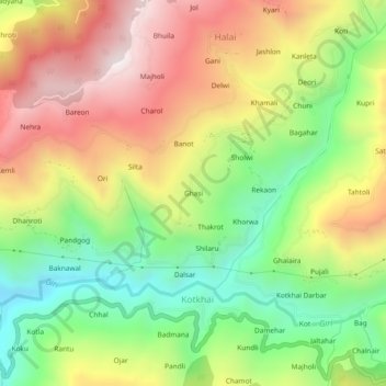
Name: Ghasi topographic map, elevation, terrain.
Location: Ghasi, Kotkhai, Shimla, Himachal Pradesh, 171202, India (31.10904 77.52014 31.14904 77.56014)
Average elevation: 6,476 ft
Minimum elevation: 5,013 ft
Maximum elevation: 8,117 ft
Thank you for supporting this site ❤️
Make a donation
Make a donation
Gear up for your next adventure:
As an Amazon Associate, this site earns from qualifying purchases at no extra cost to you.