Geolocate

Bristol topographic map

Click on the map to display elevation.

About this map

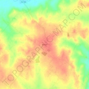
Name: Bristol topographic map, elevation, terrain.

Location: Bristol, Ellis County, Texas, United States (32.44153 -96.58999 32.48153 -96.54999)

Average elevation: 456 ft

Minimum elevation: 344 ft

Maximum elevation: 518 ft

Ellis County trails, hiking, mountain biking, running and outdoor activities

Gear up for your next adventure:

📡Handheld GPS Device - Reliable handheld GPS for outdoor navigation
🪶Thermal Camp Blanket - Extra warmth for cold nights
🧭Orienteering Set - Complete compass and map reading kit
🎒Trekking Poles - Sturdy poles for balance and stability on rough terrain
Backpacking Tents - Weight-optimized shelters for multi-day topographic surveys

As an Amazon Associate, this site earns from qualifying purchases at no extra cost to you.