Geolocate

Kelso topographic map

Click on the map to display elevation.

About this map

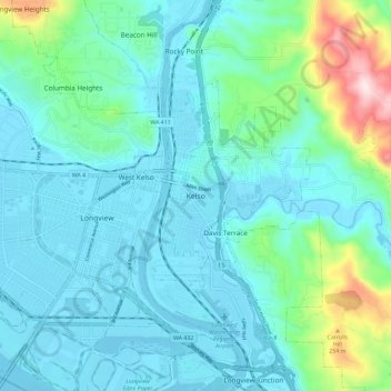
Name: Kelso topographic map, elevation, terrain.

Location: Kelso, Cowlitz County, Washington, 98626, United States (46.10212 -122.94530 46.18212 -122.86530)

Average elevation: 230 ft

Minimum elevation: -13 ft

Maximum elevation: 1,345 ft

Cowlitz County trails, hiking, mountain biking, running and outdoor activities

Gear up for your next adventure:

🔋Solar Power Banks - Keep your GPS and phone charged in remote wilderness areas
🌡️Portable Weather Meter - Track weather conditions on the trail
📌Outdoor GPS Map App - Apps and devices for digital topographic navigation
🧼Biodegradable Camping Soap - Eco‑friendly soap for outdoor hygiene
👟Trail Running Shoes - Lightweight shoes for trail runners

As an Amazon Associate, this site earns from qualifying purchases at no extra cost to you.